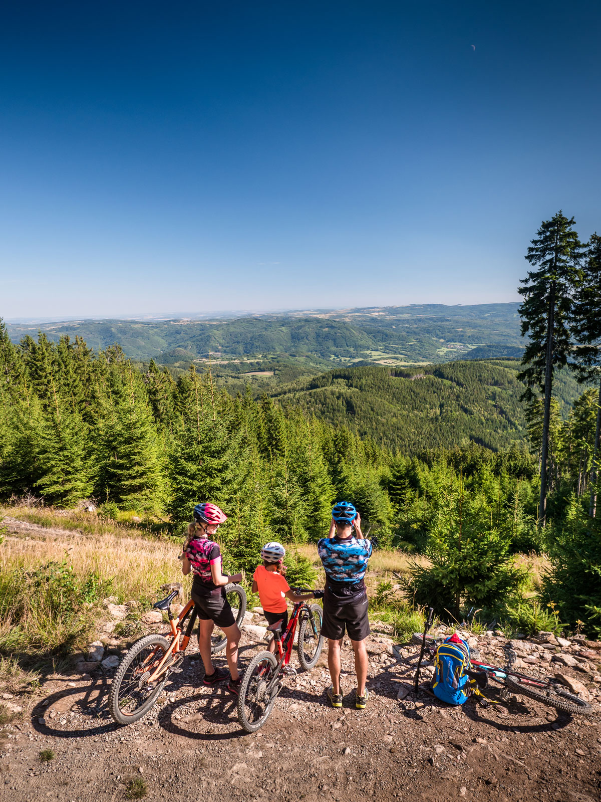
The longest trails in Europe

Trailpark Klínovec
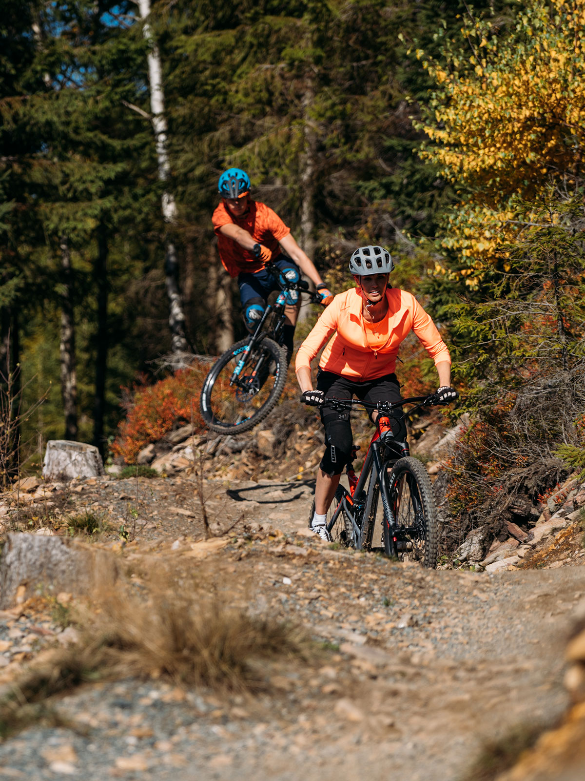
Fun on trails for everybody
Extraordinary bike experience!
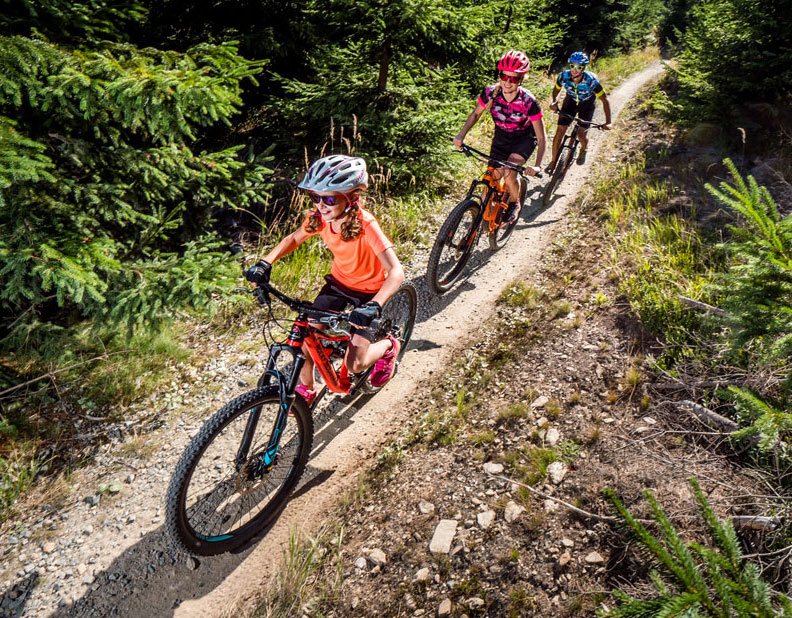
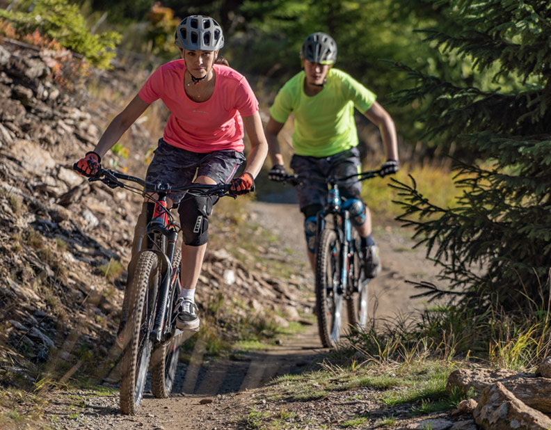
If you are a beginner or pro, if you look for a maintained trail or rather technical riding, we offer you both. Enjoy an unforgettable ride on the longest flow-trails in Europe.
Easy trails
Intermediate trails
Skillcentrum and pumptrack

Advanced trails
Difficult trails
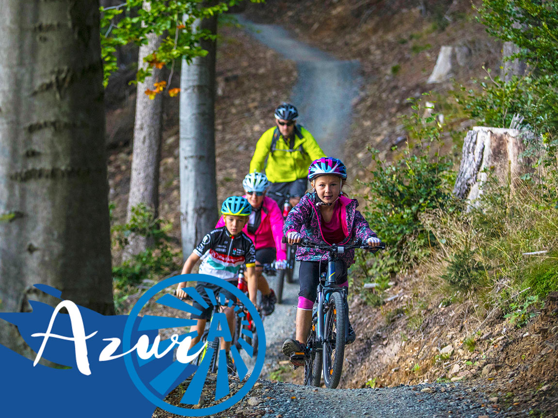
Azur | 10 km
Entry flow trail
Maintained and lightly descending trail designed for beginners and families with children.
Easy trails (marked blue) are suitable for all cyclists of all age categories and all abilities, including beginners. However, riders must have at least basic experience with riding a bicycle and must be able to control his/her bike safely on the trail.

Azur sections
1 / Na Sonnenwirbellu (On Sonnenwirbell)
Sonnenwirbel is one of the historical names for the Klínovec peak, and on some maps also for the surrounding peaks of the Klínovec massif.
2 / Pytlácká (Poacher´s)
The forests around Klínovec are full of wildlife. While designing this section, we spotted a large deer. If we were poachers, this is where we would come. However, people mainly come here to poach blueberries.
3 / Koželužna (Tannery)
One of the historical maps revealed that there was a leather processing site not far from here.
4 / Milíře (Charcoal kilns)
In this section, we encountered numerous charcoal pits. These are probably the remains of old charcoal kilns – devices for producing charcoal, which ensure slow burning with minimal air access but at a relatively high temperature, causing the wood inside the kiln to carbonize.
5 / Nad Suchou (Above Suchá)
This section passes over Suchá twice. It is located above the village of Suchá, and in the middle it crosses the Suchá water stream, which, despite its name (“dry”), can be quite powerful.
6 / Ochsenraum
The slopes here are some of the steepest in the entire area, and it must have been really hard work that only a few oxen (ochse – ox, ochsen – hard work) could manage.
7 / Lehmgruben
The slopes to the right of this trail are rich in high-quality soil. Our ancestors knew this when they named this area, which translates as clay pit or clay mine (lehm – clay, gruben – to dig). You will circle one of these pits right at the beginning of this section.
8 / Vogelherd
A term from a historical map that does not make much sense even to experts in the German dialect spoken in the Ore Mountains. After thorough research, we discovered that it probably refers to a place where birds gathered. The name of the local crossroads, Sletiště, is also derived from this term.
9 / Adalbert
Adalbert, known as Vojtěch in Czech, is the name of one of the important tunnels in the Jáchymov mining district. According to maps, it was located in the lowest parts of the slope where this section is located today.
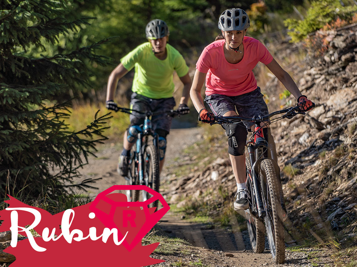
Rubin | 8 km
Endless flow
Swinging, playful and continuously descending flowtrail. Contains many bumps, rollers and berms. Favorite choice of riders from intermediate level to experienced trail enthusiasts.
Trails of middle difficulty (marked red) are designed for cyclists who are experienced in terrain riding on narrow single-track trails and who can master riding easy trails in Trail Park Klínovec without any problems.
Rubin sections
1 / Bartum
Bartholomäusberg (St. Bartholomew’s Mountain) is an alternative historical name for Klínovec and its surrounding peaks.
2 / Prales (Virgin Forest)
In the past, the Ore Mountains formed an impenetrable forest barrier, which the Romans considered to be a safe protection against a possible invasion by Germanic tribes. Something of the impenetrability and mysterious atmosphere of the forest, which was called Miriquidi or Dunkelwald (dark forest), still remains in this hard-to-reach part of the Klínovec forests.
3 / Starkenberg
This section is located on one of the partial ridges of the Klínovec massif. Translated, this probably means “wide ridge.” The moderate slopes here made it possible to place a fun and playful section.
4 / Salzereith
The word reith refers to a clearing or glade. Salz means salt. This is probably an area where people placed a source of salt for wild forest animals – a so-called salt lick.
5 / Klunker
Historical maps refer to the name Klinkerhau. Hau means clearing or glade. If you take the word Klinker and swap one letter, you get the word klunker. If you don’t know what a klunker is, you should use Google!
6 / Zvonivka
Once again, the Klinkerhau area. According to the translator, Klinker means brick or clinker. Zvonivka is a type of brick. And also a great section.
7 / Mittelberg
Mittelberg refers to the lower slopes below Klínovec. Historical maps distinguish between Mittelberg, known to us as Černý vrch, and Grosser Mittelberg, which refers to the lower levels of the Klínovec massif. This section is located on these slopes.
8 / Edellen
Edellen, Edellautstollen, or Saxon Nobles’ Mine – different names for one of the most important historical mines. According to maps, it was located in the lowest parts of the slope where this section passes today.
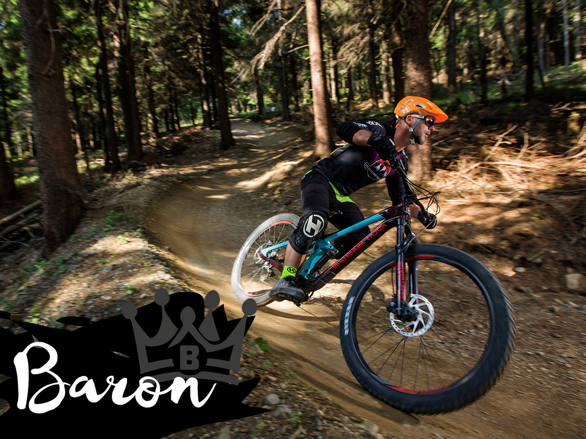
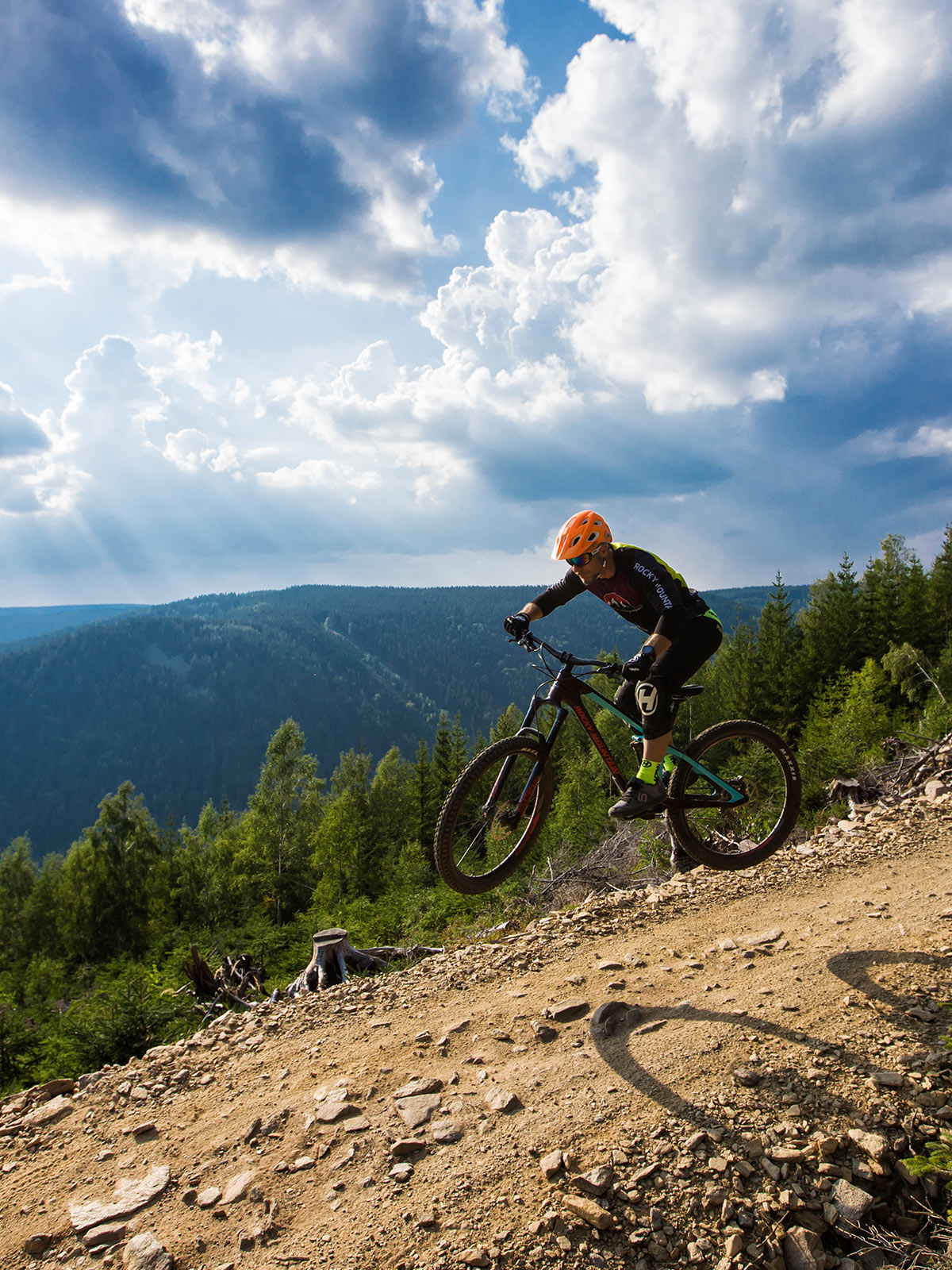
Baron | 6 km
Perfect mix of flow,
jumps and technical riding
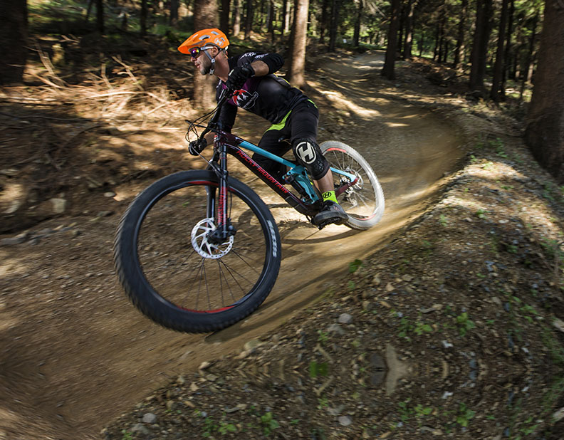
Playground for experienced bikers. Trail with natural surface with bigger rollers, berms and jumps, steeper descents and basic rockgardens.
Challenging trails (marked black) are designed for advanced cyclists with rich experience in riding on narrow forest trails and high level of skills in bike control in terrain.
Baron sections
1 / Panorama
2 / Kracklreith
Apparently, it was an inaccessible clearing that had to be scrambled or climbed up to (Kraxeln). The steep slopes surrounding it confirm these assumptions. Today, instead of hard work, riders can enjoy a series of five playful banked turns.
3 / Černoles (Black Forest)
Historical maps refer to the forests stretching from here to the Klínovecký potok valley as Schwarzwald. That is, the Black Forest.
4 / Cihelna
We are once again passing through the Klinkerhau area. Since klinker means brick, there was probably suitable soil here for brick production.
5 / Slínek (Clinker)
Clinker is lumps or concretions produced by sintering (bonding without melting to the point of liquefaction) limestone and aluminosilicate clay material, which is formed during production in a cement kiln. They can also be stony residues from coal combustion or from kilns. All of this can be referred to as clinker, which is why the fifth section of Baron, located in the Klinkerhau area, takes its name from this term.
6 / Lobegott Schmidt
Karl Friedrich Lobegott Schmidt (1820 – 1908) was a mining tradesman (so called loading man). Among miners the loading men had a special position. The last loading man in this area was Karl Friedrich Lobegott Schmidt from Mílov, who at the age of 67 obeyed divine inspiration according to a legend and made an adit into hard rock. At the age of 80 he was exhausted. He never reached his goal.
Mr. Schmidt, however made it to the brochure Significant personalities of the Ore Mountains, his portrait even adorns the cover of the booklet. His story inspired us and we called this section after him because the slopes here are extremely rocky. This section, however, does not reach its goal. Glück auf!
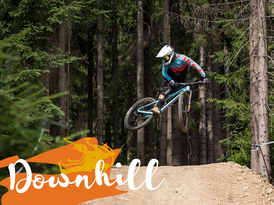
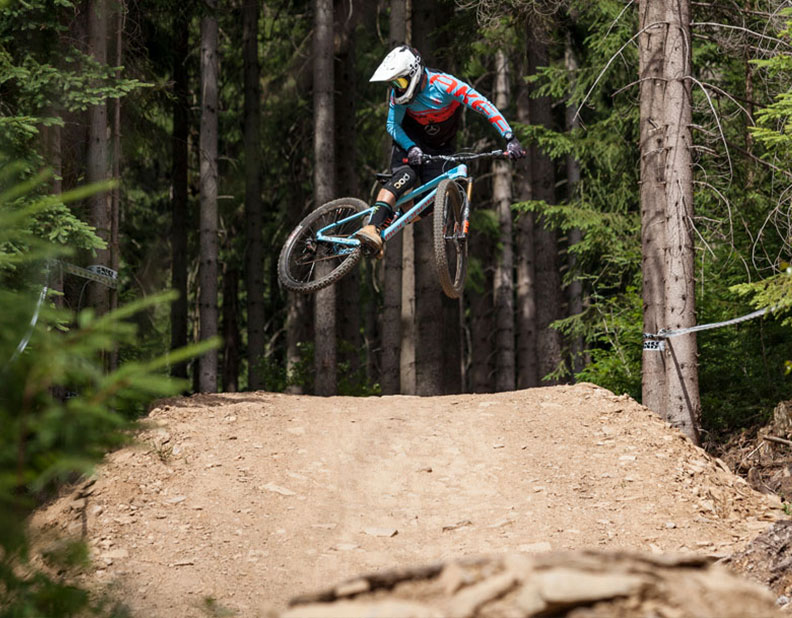
Downhill | 3 km
World class race track
The downhill track is designed for true experts. With almost thirty years of tradition, our race track is the venue for the prestigious iXS Downhill Cup, the Czech Downhill Championships, and the Czech Enduro Series. The track features a dozen difficult jumps up to ten meters long, which will not forgive any mistakes made by riders. Compared to the Illegal trail, riders can reach speeds of up to 40 km/h here. Here, too, all protective gear and a full-suspension bike with a minimum lift of 150 mm are absolutely necessary.
Difficult trails (marked orange – freeride and downhill trails) are suitable only for technically very advanced cyclists with high level of skills in bike control and rich experience with highly technical and extremely challenging terrain. Rider must easily master riding on unstable and slippery surface, high drops, long and high jumps, steep descents and ride on diverted slope.
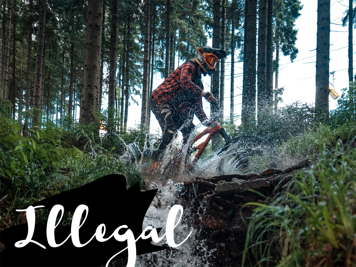
Illegal | 3 km
Pure adrenalin
Trail Illegal is considered by many to be the hardest trail in the whole Klínovec. It is also a traditional trail during the races of the prestigious Czech Enduro Series. The natural, rocky surface supplemented by slippery roots, stream crossings or jumps requires 100% rider concentration throughout the ride. Protective equipment is a must, i.e. integral helmet, downhill goggles, spine protector, gloves and knee and elbow pads. The rider should be equipped with a full suspension wheel with a minimum lift of 120 mm.
Difficult trails (marked orange – freeride and downhill trails) are suitable only for technically very advanced cyclists with high level of skills in bike control and rich experience with highly technical and extremely challenging terrain. Rider must easily master riding on unstable and slippery surface, high drops, long and high jumps, steep descents and ride on diverted slope.
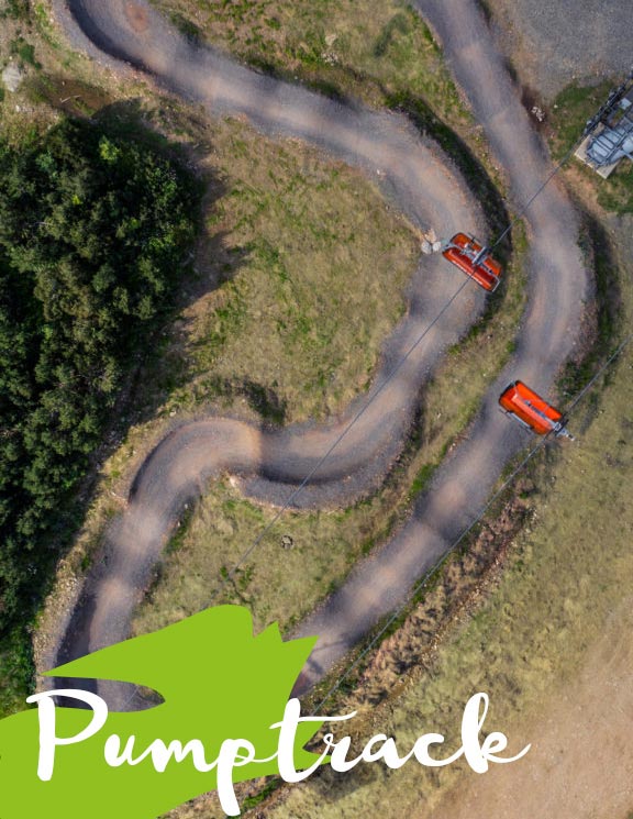
Skillcentrum & pumptrack
Test your skills
Skillcentre and pumptrack at the peak of Klínovec right at the exit of the cable car use the possibilities of our skillcentre. As a rider, you have the opportunity to try out the different elements you will encounter on our trails on the way down and help you decide which trail to choose. The Skillcentre is also great for practicing skills or keeping the kids entertained during a break or lunch.
Trails and sections
Names of the sections are inspired mainly by historical and forest maps. We wanted the trails to take you to unknown places and at the same time the names to refer to the historical places they lead through. We had several maps available, including Forest Map in the 1:11520 map scale, created by H. Bretschneider at Forest University in Vienna in 1891, Mining Map of the Jachymov Region from 1774, Mining Map of Central Ore Mountains in the scale 1:22 300 created by Christian Höller in Vienna and other historical military maps.